The traffic changes to be made during this trial are notably stronger that the SFCTA had proposed back in May. The new configuration will leave a virtually car free road Eastbound, East of 8th Street.
Showing posts with label san francisco. Show all posts
Thursday, September 10, 2009
Eagerly Awaiting the New market Street
The traffic changes to be made during this trial are notably stronger that the SFCTA had proposed back in May. The new configuration will leave a virtually car free road Eastbound, East of 8th Street.
Wednesday, February 4, 2009
America's Most Improved Commutes
I followed Streetsblog LA to this story: SF has the fourth most improved commute in America, behind Boston, Milwaukee and Cleveland.
According to Forbes Magazine,
The numbers for San Francisco:
According to Forbes Magazine,
First, we looked at how many lane miles of roads have been added to metropolitan areas since 2000 relative to the increase in traffic flow. ...I wouldn't peg this as a particularly rigorous measurement, but it's nice they recognized Transit as an important component of regional transportation.
Second, we assessed improvements to public transportation systems using ridership data from the U.S. Census and American Community Survey. The more people who use public transit, the better that system meets individuals' commuting needs.
The numbers for San Francisco:
- Improvement in road construction versus traffic since 2000: -0.7% (17th best)
- Commuters using public transit in 2000: 9.4% of metro residents
- Commuters using public transit in 2007: 13.6% (3rd best increase)
- Traffic delays, per commuter, per year, due to congestion: 60 hours
Wednesday, January 28, 2009
If Traffic is Bad, And Freeways Cause Urban Traffic...
Why don't we remove the freeways?
Yesterday I pointed out a great article in Scientific American documenting the plain, simple reality that removing freeways improves traffic flow in urban areas. That article leads with the example of an elevated freeway in Seoul, Korea that was removed, and the improvement in traffic flow that resulted.
Reading up a little more, I found an excellent website devoted to real-world examples of urban freeways that have been nixed. The Preservation Institute of Berkeley, CA tells the whole story of the Cheonggye Freeway. From river to freeway and back again in less than half a century, the Cheonggye is a remarkable case, but freeway removal in cities around the world are strikingly similar.
Here in SF we have two good cases where freeways were closed and the sky remained firmly up. The Embarcadero and Central Freeways were removed after much hair-pulling and hand wringing, and replaced with surface streets that have proven to be wildly successful.
View Larger Map
Here's a little map of the scars across San Francisco caused by elevated freeways. Blue represents extant freeway, green represents those removed.
These monstrosities cut off neighborhoods and blight the area for blocks around. This map doesn't even highlight those traffic sewers that some of our city streets have been turned into in a vain effort to whisk people on and off these concrete octopuses. Streets like Alemany Blvd, San Jose Ave and Division St.
If we can see that these misguided structures cause tangible problems, and we know that removing them improves traffic flow while eliminating those problems, then why the hell don't we tear them all down?
Yesterday I pointed out a great article in Scientific American documenting the plain, simple reality that removing freeways improves traffic flow in urban areas. That article leads with the example of an elevated freeway in Seoul, Korea that was removed, and the improvement in traffic flow that resulted.
Reading up a little more, I found an excellent website devoted to real-world examples of urban freeways that have been nixed. The Preservation Institute of Berkeley, CA tells the whole story of the Cheonggye Freeway. From river to freeway and back again in less than half a century, the Cheonggye is a remarkable case, but freeway removal in cities around the world are strikingly similar.
Here in SF we have two good cases where freeways were closed and the sky remained firmly up. The Embarcadero and Central Freeways were removed after much hair-pulling and hand wringing, and replaced with surface streets that have proven to be wildly successful.
View Larger Map
Here's a little map of the scars across San Francisco caused by elevated freeways. Blue represents extant freeway, green represents those removed.
These monstrosities cut off neighborhoods and blight the area for blocks around. This map doesn't even highlight those traffic sewers that some of our city streets have been turned into in a vain effort to whisk people on and off these concrete octopuses. Streets like Alemany Blvd, San Jose Ave and Division St.
If we can see that these misguided structures cause tangible problems, and we know that removing them improves traffic flow while eliminating those problems, then why the hell don't we tear them all down?
Labels:
car,
freeway,
map,
pedestrianism,
san francisco,
SF,
traffic,
traffic sewer
Tuesday, January 27, 2009
Reality: Freeways Cause Traffic
The old-fashioned street grid is the best way to circulate auto, bicycle, and pedestrian traffic.
This makes sense to anyone who spends time in both grid-network areas as well as freeway/artery areas, and has begun to be accepted by more forward-thinking planners.
Now from no less reputable a source than Scientific American comes this article showing experimental and empirical evidence directly supporting this idea as well.
This makes sense to anyone who spends time in both grid-network areas as well as freeway/artery areas, and has begun to be accepted by more forward-thinking planners.
Now from no less reputable a source than Scientific American comes this article showing experimental and empirical evidence directly supporting this idea as well.
But in the 21st century, economic and environmental problems are bringing new scrutiny to the idea that limiting spaces for cars may move more people more efficiently.As documented in Seoul, Boston and Montgomery, Alabama, the idea is that [gasp] wide arterial roads induce demand, which causes gridlock. Removing those expressways causes traffic to move more smoothly than it did before.
In the Boston example, Gastner’s team found that six possible road closures, including parts of Charles and Main streets, would reduce the delay under the selfish-driving scenario.The article also documents positive results from conversion of divided rights of way to the "shared street" concept, or woonerf. In a woonerf, all modes of transportation are allowed on any part of the road, and traffic signals and lane markers are absent.
The idea is that the absence of traffic regulation forces drivers to take more responsibility for their actions. “The more uncomfortable the driver feels, the more he is forced to make eye contact on the street with pedestrians, other drivers and to intuitively go slower,” explains Chris Conway, a city engineer with Montgomery, Ala.And finally, author Linda Baker gives props to SF for our parking maximums:
In San Francisco, for example, developers must restrict parking to a maximum of 7 percent of a building’s square footage, a negligible amount. Although downtown employment has increased, traffic congestion is actually declining, [Patrick] Seigard says. With fewer free spaces to park, drivers seem to be switching modes, relying more on mass transit, cycling and just plain walking.Imagine that.
Labels:
freeway,
grid,
pedestrian,
san francisco,
SF,
traffic
Monday, January 12, 2009
You will be the butt of jokes if you fail to think big
Americans pride ourselves on thinking big and following through on those dreams. Nobody would argue that it's anything but a point of pride to have the tallest building, the longest bridge span, etc.
That mindset is present even when planning the less sexy segments of our public infrastructure. Unfortunately that's mostly only true for asphalt projects. From Jon, commenting on The Overhead Wire:
Replace Boston 50-80 years ago with SF 40 years ago and you have the situation as I see it.
To the extent that there is any big-thinking going on here, it's poo-poohed by the inbred pool of political power. The most we seem to get are proposals to push BART to the edges of the state or the world's slowest BRT. Our much-championed Transit Effectiveness Project (TEP) is a "consolidation of service" (Muni's euphemism, not mine) not a plan for a truly effective transportation network. Heaven forbid we move the region or even the densest city outside of Manhattan away from a 1:1 parking ratio.
What if this is stimulus is our chance to make game-changing capital improvements, along the lines of the Market Street tunnel, and we blow it? We'll look like fools, and more than likely do it anyway decades late and for billions more.
That mindset is present even when planning the less sexy segments of our public infrastructure. Unfortunately that's mostly only true for asphalt projects. From Jon, commenting on The Overhead Wire:
the urban ring should really be subway, too bad boston spent all their money on the big dig back when subways were still being built.
this is what gets me, a transit oriented city like boston (nyc, chicago, philly too) has for the most part the same subway system that it had 50-80 years ago. for any new expansion they have to settle for buses when grade separated rail is whats needed. they need to be ambitious now and plan some subway and fight for the federal transit money to pay for it.
Replace Boston 50-80 years ago with SF 40 years ago and you have the situation as I see it.
To the extent that there is any big-thinking going on here, it's poo-poohed by the inbred pool of political power. The most we seem to get are proposals to push BART to the edges of the state or the world's slowest BRT. Our much-championed Transit Effectiveness Project (TEP) is a "consolidation of service" (Muni's euphemism, not mine) not a plan for a truly effective transportation network. Heaven forbid we move the region or even the densest city outside of Manhattan away from a 1:1 parking ratio.
What if this is stimulus is our chance to make game-changing capital improvements, along the lines of the Market Street tunnel, and we blow it? We'll look like fools, and more than likely do it anyway decades late and for billions more.
Thursday, January 8, 2009
The Silver Bullet or the Werewolf?
The line in support of congestion pricing starts here.
I can't think of a single reason not to apply congestion pricing to San Francisco.
Think of Soviet shoppers spending their lives in endless queues to purchase artificially low-priced but exceedingly scarce goods. Then think of Americans who can fulfill nearly any consumerist fantasy quickly but at a monetary cost. Free but congested roads have left us shivering on the streets of Moscow.
I can't think of a single reason not to apply congestion pricing to San Francisco.
Labels:
congestion pricing,
economics,
san francisco,
SF,
traffic
Wednesday, December 31, 2008
From Congestion Pricing to the Geary Corridor
Wow, check out the comments below this Calitics post on the pre-premilinary congestion pricing plan for downtown SF. The topic quickly digresses to the Geary corridor, or rather what to do about transit along Geary St Blvd Expressway traffic sewer. Clearly this is a hot topic, in fact it's considered one of the regional corridors most in need of a good transit solution.
As I happened to mention in the previous post, Geary was the birthplace of Muni. The old A, B, C streetcar lines ran down Geary. These lines were ripped out, however, in part because the original BART plan had a line going under Geary:

As I happened to mention in the previous post, Geary was the birthplace of Muni. The old A, B, C streetcar lines ran down Geary. These lines were ripped out, however, in part because the original BART plan had a line going under Geary:
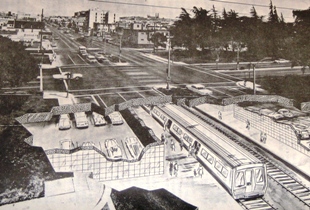
Artist's conception of a proposed BART station below Geary and Park Presidio Blvds
The idea was that a streetcar line above ground provided redundant service to the rapid, heavy rail line below. In later years the entire Geary corridor was further redesigned to move motor traffic more quickly. The end result in 2008 2009 is that one of San Francisco's most dense neighborhoods, the Richmond District, is drastically under served by transit; most riders funnel onto the 38, which is the busiest single line in Muni's system. The entire Geary corridor is the second most heavily-traveled, with 56,473 daily boardings along its four bus lines.
There are plans in the works (though currently years away from implimentation) to remake Geary with a bus rapid transit (BRT) line down the middle. One of the alternatives discussed in the official plans is to build a BRT right of way that could be retrofitted in a few years to run light rail (a reborn B-line?) from downtown to Ocean Beach. But why wait? Are we suggesting that Geary, with 30,000 more daily riders that pre-T Third St or 5,000 more daily riders than the N-Judah (Muni's busiest extant rail line), is less deserving of full-blown light rail than those lines?
Geary needs light rail now! More than that, it needs comprehensive transit options, with convenient local service and rapid cross-town access. Geary needs what Market St. has right now: A streetcar on the surface (preferably in its own ROW) to move neighbors to shops and provide convenient access to local amenities, and a subway line below to get commuters across town quickly.
Arguments that demand for transit need to be proven before a system so robust is built are flawed to begin with, but in the case of Geary, the demand for ridership is already proven. Induced demand has been proven in road projects, and a similar results can happen along "overbuilt" transit lines. To give San Francisco a web of transit arteries would be to build a system that is capable of accomodating growth for the future.
There are plans in the works (though currently years away from implimentation) to remake Geary with a bus rapid transit (BRT) line down the middle. One of the alternatives discussed in the official plans is to build a BRT right of way that could be retrofitted in a few years to run light rail (a reborn B-line?) from downtown to Ocean Beach. But why wait? Are we suggesting that Geary, with 30,000 more daily riders that pre-T Third St or 5,000 more daily riders than the N-Judah (Muni's busiest extant rail line), is less deserving of full-blown light rail than those lines?
Geary needs light rail now! More than that, it needs comprehensive transit options, with convenient local service and rapid cross-town access. Geary needs what Market St. has right now: A streetcar on the surface (preferably in its own ROW) to move neighbors to shops and provide convenient access to local amenities, and a subway line below to get commuters across town quickly.
Arguments that demand for transit need to be proven before a system so robust is built are flawed to begin with, but in the case of Geary, the demand for ridership is already proven. Induced demand has been proven in road projects, and a similar results can happen along "overbuilt" transit lines. To give San Francisco a web of transit arteries would be to build a system that is capable of accomodating growth for the future.
Labels:
BART,
BRT,
congestion pricing,
Geary,
muni,
san francisco,
SF
Sunday, December 28, 2008
Happy B-day Muni!

The Market Street Railway blog has the story. 96 years ago today then-Mayor James "Sunny Jim" Rolph personally operated the first run along the A-Geary line. The story of how San Francisco's first publicly-owned streetcar line came to be, and the deliberate collapse of it and the rest of the system half a century later is well worth a read. The Transbay Blog also has an excellent history.
There are many of us who would like to see the return of this kind of infrastructure investment. A renewed dedication to our publicly-owned mass transit system. San Francisco is a rare city in the US because it is possible to live here without owning or ever using a car. But those of us who do live our car-free lives here can't help but feel the strain of a piecemeal transportation system that routinely takes second banana to private auto traffic on our city streets.
Fortunately this region has no share of amateur visionaries who have put together their dream maps of public transportation in SF and the Bay Area:
Transbay Blog
SF Cityscape
The Overhead Wire
I've got my own ideas, which I'll get around to illustrating as beautifully as these someday. The Overhead Wire describes the benefit of these fantasy maps very well:
There are many of us who would like to see the return of this kind of infrastructure investment. A renewed dedication to our publicly-owned mass transit system. San Francisco is a rare city in the US because it is possible to live here without owning or ever using a car. But those of us who do live our car-free lives here can't help but feel the strain of a piecemeal transportation system that routinely takes second banana to private auto traffic on our city streets.
Fortunately this region has no share of amateur visionaries who have put together their dream maps of public transportation in SF and the Bay Area:
Transbay Blog
SF Cityscape
The Overhead Wire
I've got my own ideas, which I'll get around to illustrating as beautifully as these someday. The Overhead Wire describes the benefit of these fantasy maps very well:
Why do I love fantasy transit network maps? Because unlike bus and automobile, it inspires people to think big and imagine. I think we could use some imagination these days. I've always believed it was good for you.
Tuesday, December 16, 2008
Pedestrianism Vol. 2
Pedestrianism Vol. 2 on Vimeo.
An on-the-ground look at one of the worst streets in San Francisco. The stretch of trash-strewn pavement below the Central Skyway is actually three streets that have been combined into an expressway below the elevated freeway structure. Division Street runs between the Caltrain yard and Bryant St. Division curves South at Bryant and the expressway becomes 13th St it crosses Mission. From Mission it becomes Duboce and gradually narrows and calms down. The Skyway leaves the expressway, curving North and touching down on Market and Octavia.
With three lanes of traffic along most of the road, the expressway has roughly the same road space as the freeway above it. Pedestrians trying to make their way along or across this stretch of town have to deal with loud, echoing traffic noise; multi-street intersections, often without Pedestrian signals; off- and on-ramps for the Skyway; incomplete sidewalks and illegally dumped garbage. The blight surrounding this freeway and the vacant Caltrans properties along its way is noticable for blocks in either direction.
In 1999 the Central Freeway was demolished back to Market Street. The stretch of Octavia Blvd along its former route has since blossomed. Regrettably, it is very unlikely that the Division/13th/Duboce traffic sewer has any hope of a similar fate.
Labels:
pedestrian,
pedestrianism,
san francisco,
SF,
walking
One more reason to look forward to January
One of the best sources of livable streets news out there, NYC-based Streetsblog, is adding a third outlet to its expanding network - one I personally could not be happier about.
Streetsblog San Francisco will join the New York and LA chapters next month. This will give the Bay Area some of the best progressive transportation journalism in the world. Other well-renown local blogs include The Overhead Wire and Transbay Blog.
Labels:
bay area,
blog,
san francisco,
SF,
streetsblog
Subscribe to:
Posts (Atom)